.png)
See More. Plan Better.
With crystal–clear IFR and VFR charts that stay perfectly legible — even when you zoom way out — and better weather overlays for better decisions.
See what you've been missing. 8Flight give you the highest-resolution charts and 9x more screen space so you always see what matters.
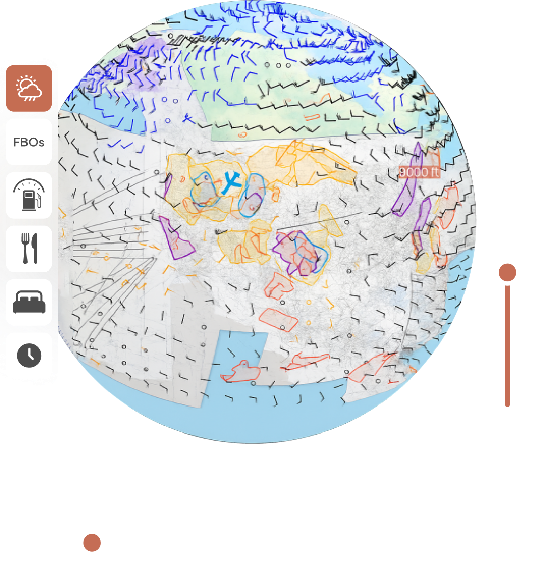
Faster Overlays Mean Easier Decisions
Visualize forecast radar, clouds, icing, turbulence, winds aloft color coded by temperature, and more. Compare times and altitudes instantly instead of reloading between each one, so you can immediately tell how they differ. It's over 100x faster than ForeFlight with 300x more data.
More Reasons Pilots Trust 8Flight’s Charts

Multiple Basemaps
Switch between 8Flight's custom vector basemap, VFR and IFR charts, and aerial views. Even display terrain and weather at the same time.
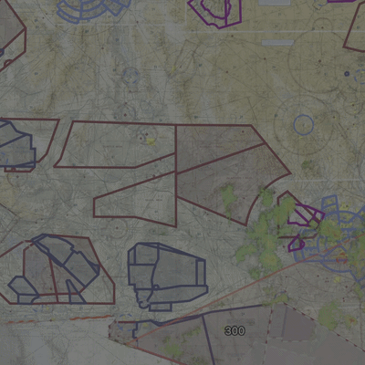
Military Airspace Status
See real-time restricted and MOA airspace status so you never fly blind into active zones.
Zoom-Proof Clarity
No need to zoom in so far you lose all context -- all the text is legible at scale. It's like having a paper chart. Without the paper.
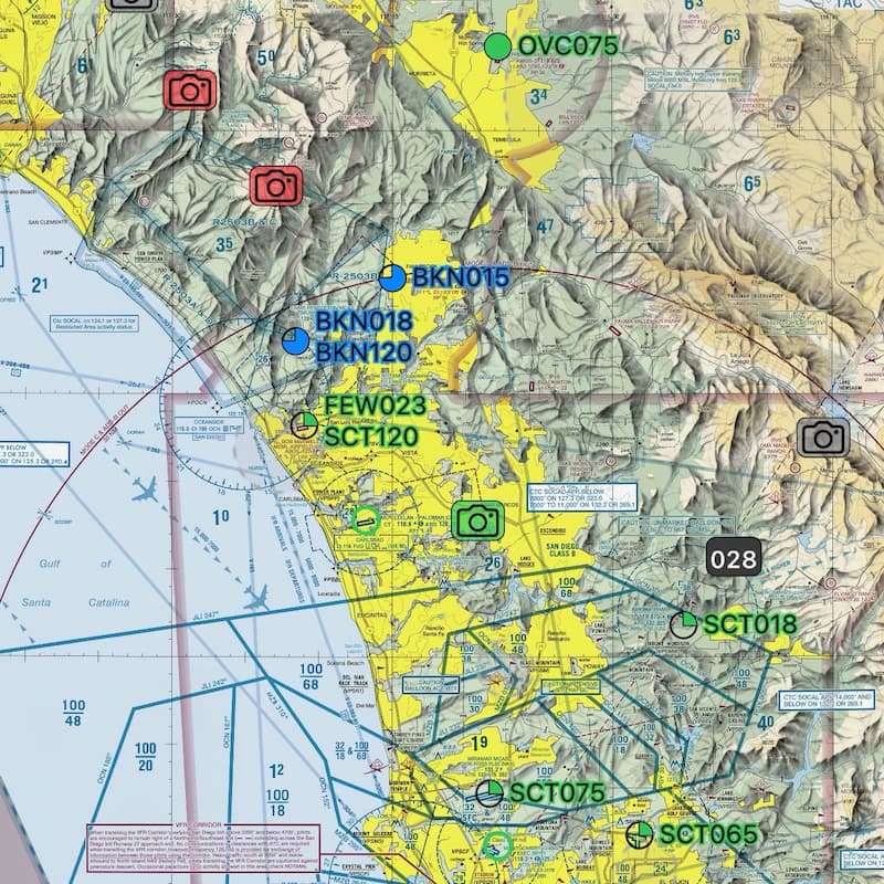
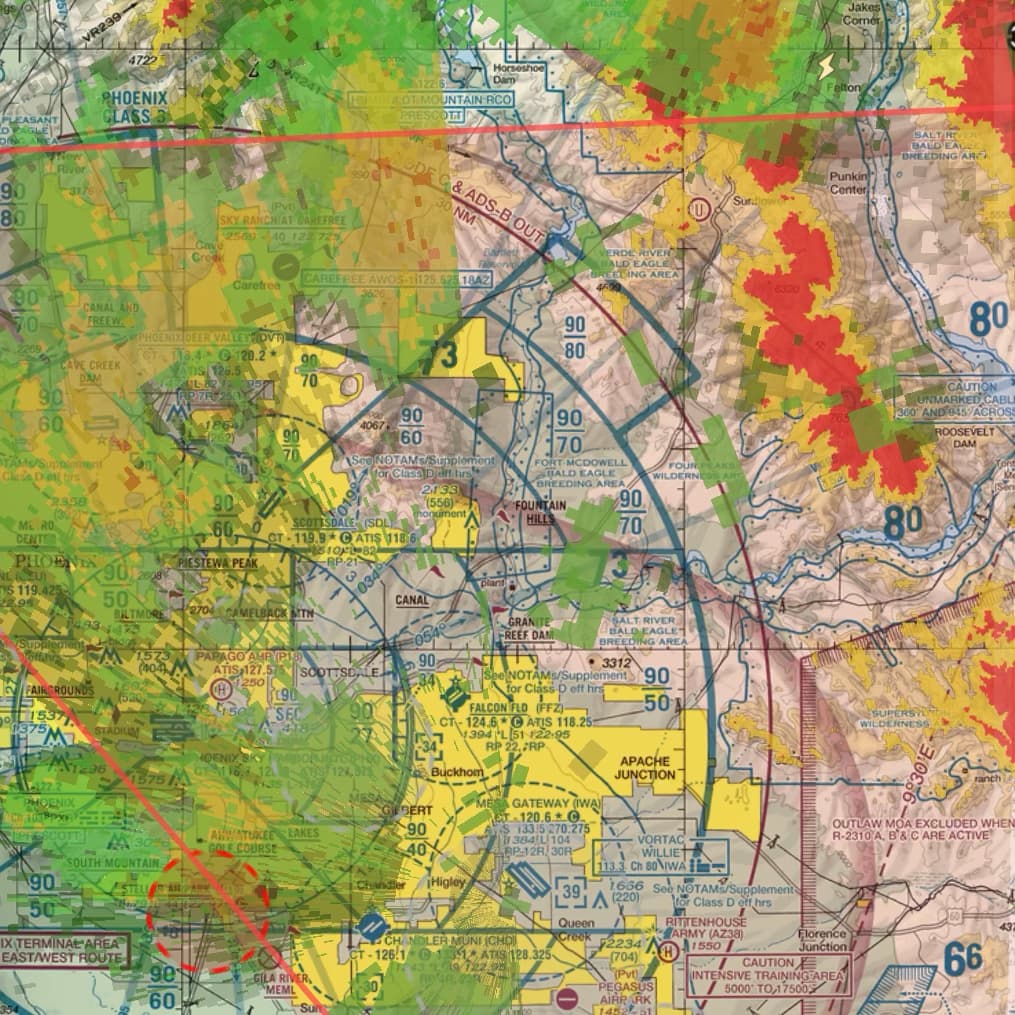
Smart Layered Overlays
Weather and NOTAMs are smartly labeled and intelligently decluttered by what's important, not what's biggest or fits a certain way on the screen -- keeping everything neat, but not hidden.